
價格:免費
更新日期:2019-06-19
檔案大小:29.9 MB
目前版本:1.1.1
版本需求:需要 iOS 11.0 或以上版本。與 iPhone、iPad 及 iPod touch 相容。
支援語言:巴克摩文挪威文, 英語
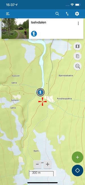
Norgekart outdoors is an app for those who want to bring with them the best maps on a trip in Norway. In addition to exploring many different maps and map layers, you can also register your own POIs, routes and track logs. Now also with trip suggestions from telltur.no and godtur.no (requires subscription).
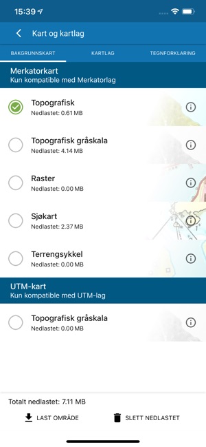
Norgekart outdoors offer free online use of the following maps (offline with subscriptions):
- Topographic color and grayscale maps.
- Raster
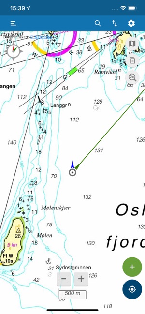
- Sea map
- Mountainbike
A feature-rich map app where the following is available for free:
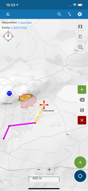
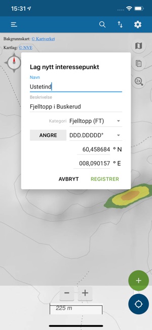
- Registration of your own points of interest
- Recording of GPS track logs
- Export, import and share GPX files
- Digitization of routes
- Compass
- Display of own position in map
- Rotation of map according to compass or GPS course
- Short line showing GPS history
- Various location formats such as MGRS and UTM
- Line indicating GPS course.
The subscription Premium can be purchased for 59 NOK a year. This subscription gives you access to a variety of map layers and you can download and save maps for offline use. You can also log in and exchange registered data with your other mobile devices and the map portal https://norgeskart.avinet.no/.
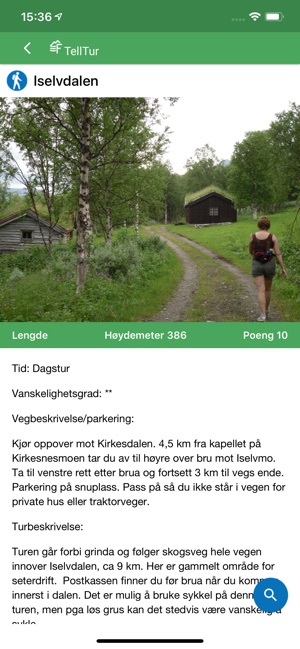
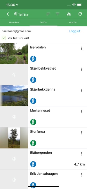
Premium now also gives you access to trip suggestions from the hiking portal godtur.no. Download and explore trips recommended by godtur.no's users.
TellTur is now included in Premium. This allows the user to log in and download trip destinations and routes from https://www.telltur.no/. TellTur is a solution for mailbox trim where users compete with each other to visit most trip destinations. When the user reaches a destination, the app automatically displays a dialog in order for the user to report that the destination has been visited.
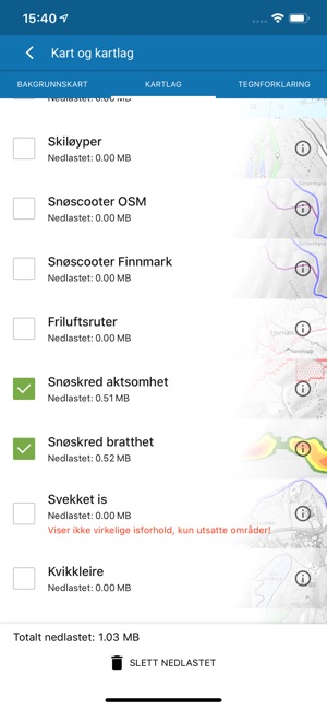
Map layers activated by the Premium subscription:
- Properties with boundaries
- Pistes
- Snowmobile trails
- Open air routes
- Avalanche awareness
- Avalanche steepness
- Weakened ice
- Clay
- Conservation areas
- Government secured outdoor areas
- orienteering
- Radon awareness
- Cultural heritage
- Snow depth
- Fresh snow last day
- Skiing conditions
- UTM grid
- Sea depth
The following applies to the auto-renewable subscriptions:
- Payment will be charged to iTunes Account at confirmation of purchase
- Subscription automatically renews unless auto-renew is turned off at least 24-hours before the end of the current period
- Account will be charged for renewal within 24-hours prior to the end of the current period, and identify the cost of the renewal
- Subscriptions may be managed by the user and auto-renewal may be turned off by going to the user's Account Settings after purchase
- Any unused portion of a free trial period, if offered, will be forfeited when the user purchases a subscription to that publication, where applicable
Terms of use: https://norgeskart.wiki/en/terms-of-use-norgeskart-outdoors/
Privacy policy: https://norgeskart.wiki/en/privacy-policy-norgeskart-outdoors/
支援平台:iPhone, iPad